To find the beginning of history at Fairlop is a journey back to close to half a million years as the advancing ice sheets pushed the River Thames southwards to its present course, depositing a series of river gravels that exist across east London today.
These river gravels have a huge commercial value and quarrying has evolved from diggings in the 1700’s to the modern aggregate industry.
For most of this time Britain was not yet an island.
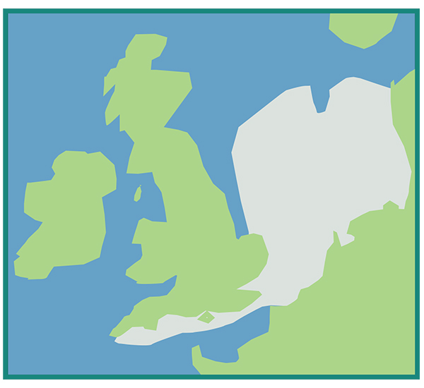
Illustration shows extent of land mass c.12,000 years ago when Britain was connected to mainland Europe. David Martin
There were four glaciations in the last 600,000 years.
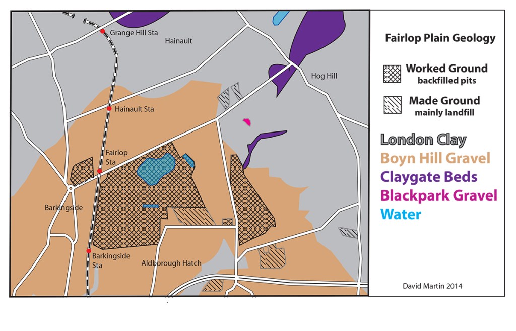
The second (476,000 to 435,000 years ago), was the biggest with the ice sheet pushing south from the Lake District to the River Thames. As it moved south, it carried with it soil and rocks over which it passed, When it melted it deposited this debris as boulder clay. The boulder clay ends at the top end of Fencepiece Road by the former Bald Hind PH- the Lambourne End Ridge. The deposits on its southern edge were eroded away by the Thames.
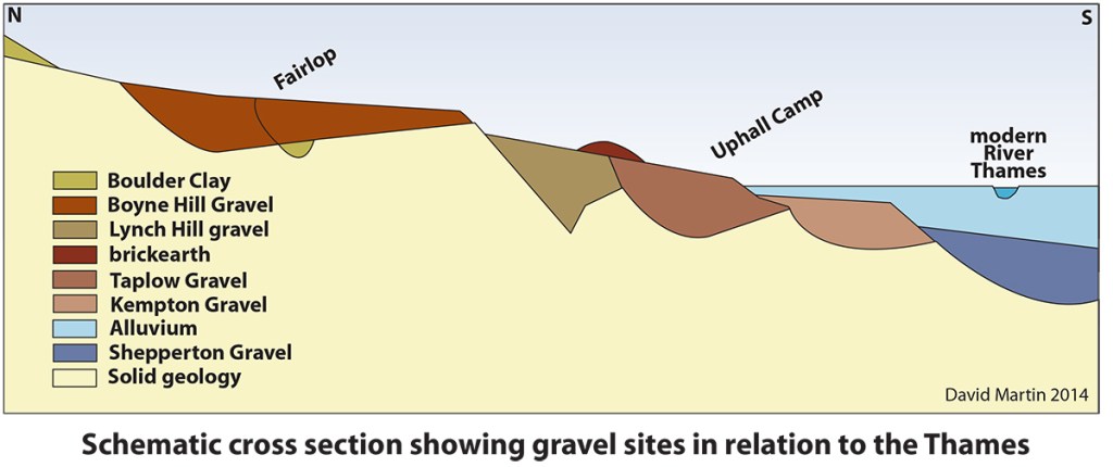
The second interglacial period (435,000 to 230,000 years ago) was long and warm, which lead to a rise in sea levels. The Boyne Hill Terrace was formed when the sea level rose by over 100 feet (30.4M) and the Thames became a wide lazy estuary, similar to what it is at Southend-on-Sea today.
If you stand at the roundabout by City Limits at Collier Row and look across Fairlop Plain, you can almost imagine the seas lapping at the base of Hog Hill and spreading across Ilford and Barking to the hills of Kent beyond. The sea level dropped and the Thames started to erode the wide Boyn Hill flood plain. The sea then rose again to about 50 feet (25.2M) and the Taplow terrace was laid down. As the climate became colder Mammoths roamed around and areas of wind blown brickearth deposits were formed.
The third glacial period (230,000 to 187,000 years ago) did not affect Fairlop Plain, although in the following interglacial (187,000 to 70,000 years ago) the Flood Plain Terrace of the Thames was formed.
The fourth glacial (70,000 to 10,000 years ago) likewise had little effect on Fairlop Plain. We are now in the fourth interglacial, waiting for the next big freeze.
It is claimed that in the 1960’s men working on gravel extraction saw ancient bones being whisked along conveyor belts. There was no chance of stopping the excavation, so quite a lot of archaeology must have been lost.

Deposits in the Ilford area provide evidence of past environments. During the 19th century excavations brick earth diggings at quarries in Essex exposed many rhinoceni, straight-tusked elephants, lion, brown bear and giant deer, and mammoths.
The finds included the skull of the ‘Ilford Mammoth’, the largest found in England. The skull, found in gravel was uncovered in Ilford Lane, near the roundabout, junction with Winston Way.The remains are on display in the Museum of London at London Wall EC2.
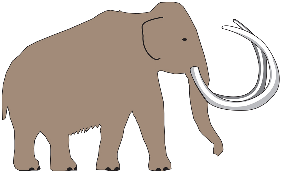
Mammoth David Martin
Open grassland was colonised by trees and dense woodland and soon cloaked by what is now east London. Occupation on the gravel land became influenced by changes to floodplain of the Thames.
References.
Dictionary of Geology by D G A Whitten & J R V Brooks, Penguin 1974
Dictionary of Archaeology by W Bray & D Trump, Penguin 1976
Britain’s Structure and Scenery by L Dudley Stamp, Fontana 1962
British Regional Geology (London and Thames Valley) by R L Sherlock,
Geological Survey & Museum HMSO 1960
OS Geological Map (1 inch) published 1935, printed on 1911 map. Reprinted 1958
From Ice Age to Essex –a history of the people and landscape of East London
by Pamela Greenwood, Dominic Perring & Peter Rowsome, Museum of London 2006
